Extending along the Brenta River, the Riviera del Brenta is now officially part of the metropolitan city of Venice. There are several charming towns that are considered to be part of the Riviera del Brenta, including Mira, Dolo, Stra, and Malcontenta, which are located along the banks of the Brenta River, in addition to towns such as Fossò, Campagna Lupia, and Vigonovo, which are situated further inland.
The Brenta, together with the Piave, is one of the two rivers that generated the Venice Lagoon. Once navigated by Venetian noblemen, this watercourse played a fundamental role as a communication route between the Venice lagoon and the Padua area. According to historians, in 589 the river also passed through Padua. Today, a cruise along the Riviera del Brenta allows curious travelers to experience a unique part of the Veneto region.
PREHISTORY OF RIVIERA DEL BRENTA
Some believe that a colony of Gauls called Mediaci lived in the current valleys of the Canale di Brenta and Valsugana. The name “Brintesis” has medieval origins, perhaps from the Latin word meaning rumble, which refers to the various floods, or from the Germanic terms “Brint” or “Brunnen” (flowing of water or fountain).
HISTORY OF RIVIERA DEL BRENTA
In the Middle Ages, controlling the river routes was the goal of all large cities. Rivers, in addition to being natural borders and sometimes obstacles against enemies, were communication routes that favored trade and, therefore, economic development.
The Brenta was the main object of the battles between the cities of Padua and Venice because, due to the delta of the river, the territories under the control of the Serenissima were not well defined.
The government of the Brenta area (which in the Veneto dialect is called La Brenta, feminine) and its delta had been a problem since ancient times. The first documents that testify to the difficulty of containing and controlling the waters date back to 1299. The many floods caused disease and difficulties in defining territorial boundaries.
During the fourteenth and fifteenth centuries, there were numerous interventions by the Serenissima Republic of Venice to control the flow of the river and its tributaries, in particular with the creation of canals. Many attempts were unsuccessful.
During the sixteenth century, following the works to close and divert the mouths of the rivers in the lagoon, all the inland areas suffered disastrous floods. Upon the outbreak of protests by the population, in 1604 the Veneto Senate established the Seven Prese, a sort of public consortia that had to coordinate the activities, the works, and the outflow of all the waters from the countryside drains into a single hydraulic system.
The Prese associated the owners of the rustic properties of a territory that had to meet for the election of three presidents. The management of the Prese was overseen by the presidents who made use of special officials to ascertain the assets and to collect taxes on landed properties.
The difficulty of managing the waters did not prevent the development of this area along the last stretch of the Brenta River that leads from Padua to Venice.
There were numerous villas built between the sixteenth and eighteenth centuries by the richest and most powerful Venetian families of the time, who recognized the river as an important resource for their controlled trade. At that time, the Riviera was reached only by boat, while the roads were built later on.
The Venetian patrician families built their rich summer residences here. The Venetian nobles were transported along the river by a boat called burchiello, which was pulled from the banks by men, oxen or horses, while the goods were transported by boats called burci. Even today the cruise along the Riviera del Brenta constitutes a tourist attraction.
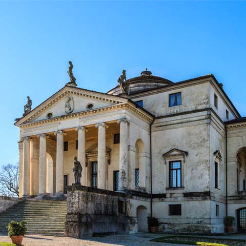
Over the years, the Riviera del Brenta has been the destination of painters, poets, scientists, writers, as well as being a place of work for many illustrious architects, above all Andrea Palladio. Each of the towns associated with the Riviera del Brenta has its own unique history.
Campagna Lupia
It appears that the territory of Campagna Lupia has been inhabited since ancient times due to many archaeological finds discovered in Lova and Lugo. Crossed in Roman times by the Via Popilia, it has preserved important archaeological artifacts.
At Campagna Lupia, the Brenta divides into two branches. Numerous objects, such as pottery and bronze instruments, attest to ancient human settlements here. The 1893 discovery of a boat dating back to the Neolithic period, now on display in the Archaeological Museum of Venice, was of particular importance.
During Roman times, there were numerous villages of peasants and fishermen who created canalizations. The first documents that speak of these places date back to the beginning of the ninth century. In the will of the Doge Giustiniano Partecipazio, dated 829, the lands of Lova were given as a gift to the monks. In the year 897, the entire area was donated by Berengar I, King of Italy, to the Bishop of Padua, and, to this day, Campagna Lupia remains part of the Diocese of Padua.
In the meantime, the town of Campagna developed autonomously. A document from 1148 shows that Campagna was already a “court,” that is, a fairly large territory, including the Lova itself, over which a lord had jurisdiction.
A document from 1276 mentions a podestà appointed by the Municipality of Padua who resided in Campagna. From 1318 to 1405 the da Carrara family ruled.
In 1373, there was a clash between the Venetians and the soldiers of Francesco da Carrara. The fights between the Republic of Venice and the Lords of Padua lasted until 1405 with the defeat of Padua. The Republic of Venice began work to protect the lagoon until its fall in 1797.
In 1836 the Austrians shortened the course of the Brenta by diverting it from Stra to Corte and only the embankments of the old Brenta remained. The area became part of the Kingdom of Italy in 1866. At the end of the nineteenth century the Municipality of Campagna changed its name and was called “Campagna Lupia,” that is “Campagna di Lova” to attest to its ancient origins.
Campolongo Maggiore
According to scholars, the name Campolongo derives from the fact that the area had been a particularly fertile and large territory for centuries. According to a document by Livy in 302 BC, the Spartan king Cleomenes I tried to invade Campolongo by traveling up the Medoacus Minor River (now the Cornio River), which connected the ancient Venetian village to the sea. Some finds attest to the settlements of the time. After the Unification of Italy, Maggiore was added to the name.
Camponogara
According to historians, the ancient Latin name was Campus Nugarium, which referred to the cultivation of walnuts.
Dolo
Dolo was a post office and center for boat building, which guaranteed the town a certain economic wellbeing. The Isola Bassa is the foremost part of the town. It is enclosed between the two branches of the Brenta. Once it was known as the island of bad weather, due to the devastating floods.
Dolo is famous for the beautiful restored mills. In the area, the remains of a Roman necropolis were found, along with large quantities of fragments of frescoes, mosaics, amphorae and excellent quality pottery. After this discovery, hypotheses about a settlement in Dolo during Roman times were confirmed.
Fiesso d’Artico
Fiesso was already mentioned in documents dating as far back as 1025 and 1028. The Roman name for Fiesso was Flexus, that is, curve, because it is located along a bend in the river. For centuries, it was the town most affected by periodic floods. “Arctic” was added in 1867 as a tribute to G.M. Arctic, the water magistrate of Venice, who designed the canal used to divert and collect the waters of the Brenta, avoiding floods.
Located a short distance from Padua, Fiesso was involved in the wars between the lords. In the fifteenth century, it definitely passed to the Republic of Venice. Under the Serenissima, the territory was embellished with splendid villas, built by Venetian nobles and merchants for their summer holidays. The Municipality assumed the title of Town Hall in 1806 with the advent of the Napoleonic Kingdom of Italy.
Today, the economy of Fiesso d’Artico is strongly linked to the footwear industry, which has made the entire Riviera del Brenta famous all over the world for the quality and style of its footwear.
Fossò
Fossò appears for the first time in an official document from the eleventh century. The name perhaps derives from Fossadum, a minor branch of the Brenta.
Some findings dating back to the fourth century BC attest to the presence of a settlement since that period. The oldest document that mentions the name of the town is a deed of sale of land, including Fossandum, and dates back to 1025.
From the twelfth to the fifteenth centuries, the Fossò family was under the rule of Padua, but they were not particularly affected by the struggles between the lords of the time.
In 1380, Fossò was the scene of a clash in which nine boats loaded with supplies for the Venetian troops engaged against the Paduan Carraresi militias sank. Falling under dominion of the Republic of Venice in the fifteenth century, Fossò lived a relatively the peaceful existence commonly attributed to small agricultural centers.
With the advent of Napoleon in 1806 and the fall of Venice, Fossò was assigned to the Brenta Department. With the defeat of Napoleon and the consequent Peace of Vienna, the Veneto area passed to Austria in 1815.
In the following century, with the outbreak of World War I, many citizens of Fossò were sent to the front. World War II significantly involved the territory as the bridge over the Brenta River was repeatedly bombed.
During the post-war period, the municipality of Fossò underwent moderate economic development, mainly linked to the production of footwear. This has favored urban expansion and the increase of the town’s population.
Mira
Mira originally had the name Ca ‘Zoxana, though it was changed in honor of Mira, the home of San Nicolò, protector of those who navigate inland waters. Already inhabited in Roman times, the area enjoyed prosperity for centuries due to commercial traffic along the river and canals.
Stra
Stra is famous throughout the world for its beautiful patrician residences and in particular for Villa Pisani, frescoed by Giovanni Battista Tiepolo.
A document dated 1105 mentions it as “strata,” or “paved road,” from which the current toponym Stra derives. In the Middle Ages and throughout the modern age, it was instead known as Fossolovara.
During the medieval period, Stra suffered serious damage due to various barbarian invasions. Then, from the sixteenth century onward, the history of the town was linked to that of Padua.
Stra was involved in numerous wars with nearby Venice before being dominated by the Ezzelini and later the lordship of Milan as a result of the treaty between Venice and the Visconti. Stra was removed from the Visconti domination by the Paduans, led by Francesco da Carrara.
In the sixteenth century, Stra became a Venetian territory for all intents and purposes. The nobles of Venice preferred it for their summer stays. On June 14,1934, Stra hosted Benito Mussolini and Adolf Hitler at Villa Pisani
Vigonovo
Vigonovo was founded by the Romans with the name of “Vicus Novus,” that is “New Village.” It was destined to replace the ancient center of Paleoveneto of which a necropolis from the third century BC remains. Attila and his army destroyed the town 492. Afterwards, Padua and Venice contended for the domination of Vigonovo for centuries.
ARCHAEOLOGY IN RIVIERA DEL BRENTA
Between Campolongo Maggiore and Campagna Lupia, archaeological excavation activities recovered the presence of partial Roman artifacts and ships.
The medieval Church of Santa Maria in Lugo hosts the Archaeological Museum of Campagna Lupia. The museum is home to pre-Roman and Roman artifacts that have been discovered in Lova in addition to a shrine. The artifacts found in the area are exhibited within the church’s windows.
The Civic Museum of Natural History located in Venice exhibits the Lova pirogue, found near Lova (Campagna Lupia). The boat, carved out of a single oak trunk, is approximately 20 feet long. At first it was believed to be a prehistoric artifact, but a radiometric survey carried out on the wood made it possible to date the boat to the Middle Ages.Travel Guides
The Veneto Region of Italy
The Cities of Veneto, Italy


